
The Most Photogenic Clouds and Where to Find Them
Clouds are nature’s masterpiece on the canvas of the sky. Their constantly evolving forms and ethereal presence create some of the most captivating images for photographers. Whether you’re a seasoned pro or a beginner, capturing clouds can elevate your photography game. Here’s a guide to the most interesting types of clouds to photograph and the best places to find them.
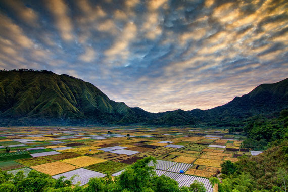
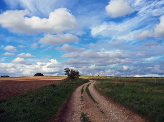
1. Cumulus Clouds:
- Appearance: These are the classic, fluffy white clouds that often resemble cotton balls. They are relatively low in the sky and have well-defined edges.
- Best for: Daytime landscapes, creating contrast against a deep blue sky.
- Where to find them: Almost everywhere, especially in fair weather. Mid-day is often a good time.
- Formation: Cumulus clouds form due to vertical convection currents caused by warming at the Earth’s surface. As warm air rises, it cools and condenses into these puffy clouds.
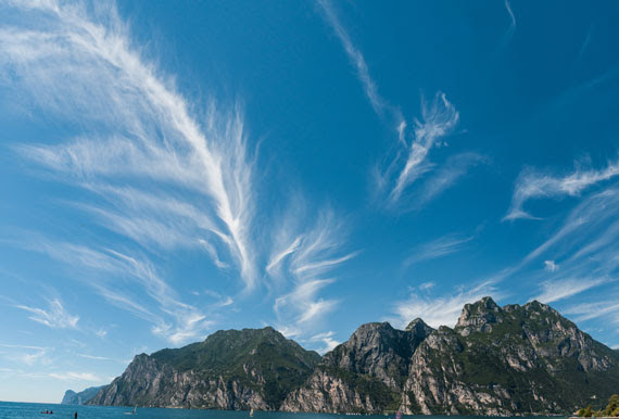
2. Cirrus Clouds:
- Appearance: Wispy and thin, cirrus clouds often look like feathery strokes painted high in the sky.
- Best for: Sunsets and sunrises, as their ice crystals can reflect vibrant colors.
- Where to find them: They are high-altitude clouds, so they are pretty much everywhere. Look up on clear days.
- Formation: Cirrus clouds form at high altitudes where the atmospheric pressure is low. Here, water vapor freezes into ice crystals. They are often formed from the outflow of other clouds or can be remnants of cumulonimbus clouds.
3. Stratus Clouds:
- Appearance: These clouds form uniform layers, often covering the sky like a blanket, leading to overcast conditions.
- Best for: Creating moody, atmospheric shots. Great for black and white photography.
- Where to find them: Common in coastal areas or during foggy mornings inland.
- Formation: Stratus clouds are typically formed through the gentle lifting of a large, relatively flat air mass. This lifting can be due to subtle features in the landscape or even an incoming weather front. They can also form from fog lifting off the ground.

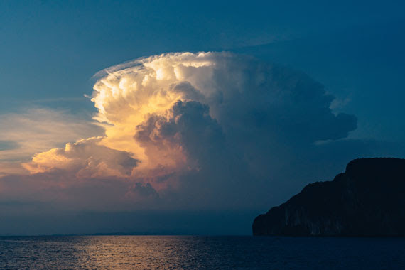
4. Cumulonimbus Clouds:
- Appearance: Towering giants, they can develop anvil tops and can produce severe weather, including thunderstorms.
- Best for: Capturing dramatic weather events like lightning or a storm’s approach.
- Where to find them: Regions with frequent thunderstorms, like the American Midwest or tropical areas during the monsoon.
- Formation: Cumulonimbus clouds are the result of vigorous convection currents. These are initiated by intense heating at the Earth’s surface. The warm air rises rapidly, and as it does, it cools and condenses. If the rising air is moist and unstable enough, it can lead to the formation of these towering storm clouds.
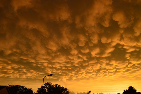
5. Mammatus Clouds:
- Appearance: They are bubble-like pouches hanging underneath the base of a cloud, often associated with severe weather.
- Best for: Adding drama and intrigue to your photos.
- Where to find them: Often seen after severe thunderstorms have passed.
- Formation: The exact cause is still debated, but one theory suggests that they form when cold air sinks down, creating pockets contrary to the usual puffy cloud formation. They’re often associated with severe weather and can appear after a storm.
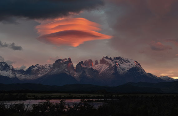
6. Lenticular Clouds:
- Appearance: They resemble UFOs or lens shapes and form over mountains or other geographical features that disrupt the flow of the air.
- Best for: Surreal landscapes, especially during sunset or sunrise when they can take on brilliant hues.
- Where to find them: Mountainous regions like the Rockies or the Andes.
- Formation: These form when moist air flows along the surface of the Earth and encounters obstructions like mountains or hills. These obstructions force the air to rise, and lenticular clouds form at the crest of the wave of rising air. Once the air passes over the obstruction and descends again, the cloud dissipates.
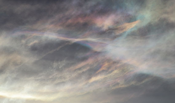
7. Nacreous (Mother of Pearl) Clouds:
- Appearance: They shimmer with iridescent colors and form in the lower stratosphere over polar regions.
- Best for: Ethereal, other-worldly shots.
- Where to find them: Polar regions during winter, especially after sunset or before sunrise.
- Formation: They form in the winter polar stratosphere at altitudes of 15,000–25,000 meters (49,000–82,000 ft). They’re made up mostly of ice crystals. The clouds’ iridescence is due to the diffraction of sunlight around the ice crystals.
Tips for Cloud Photography:
- Golden Hour Glory: The time just after sunrise or before sunset provides a soft, golden light that can make clouds look especially breathtaking.
- Use Filters: Polarizing filters can enhance the contrast between clouds and the sky.
- Patience Pays: Cloud formations can change rapidly. Waiting can sometimes reward you with a magical shot.
General Principles of Cloud Formation:
The foundation of cloud formation is the Water Cycle. Here’s a brief overview:
- Evaporation: Sun heats the Earth’s surface, causing water to evaporate from oceans, lakes, and rivers into the atmosphere.
- Condensation: As the warm, moist air rises, it cools. When the air temperature drops to its dew point, the water vapor condenses into tiny droplets around particulates in the air, forming clouds.
- Precipitation: When these water droplets combine and become heavy enough, they fall as precipitation.
In essence, clouds form when warm, moist air rises and cools, causing the water vapor in the air to condense around tiny particles, such as dust or smoke. Different atmospheric conditions, temperatures, altitudes, and more can result in the various cloud formations we see in the sky.
The world is full of breathtaking cloudscapes waiting to be captured. With patience, the right timing, and a bit of luck, photographers can capture the ethereal beauty of clouds in all their glory. So the next time you’re looking up, remember, the sky isn’t the limit—it’s the canvas!

